Good morning.
We will have a blustery and chilly day, with a high of twenty-two, and wind gusts as high as thirty mph.
I’ve added two additional points to my reply to an editorial about Janesville’s transit bus. See, The Gazette‘s Laughable, Damage-Control Editorial. The program and the editorial defense of it are, both of them, of notably poor quality.
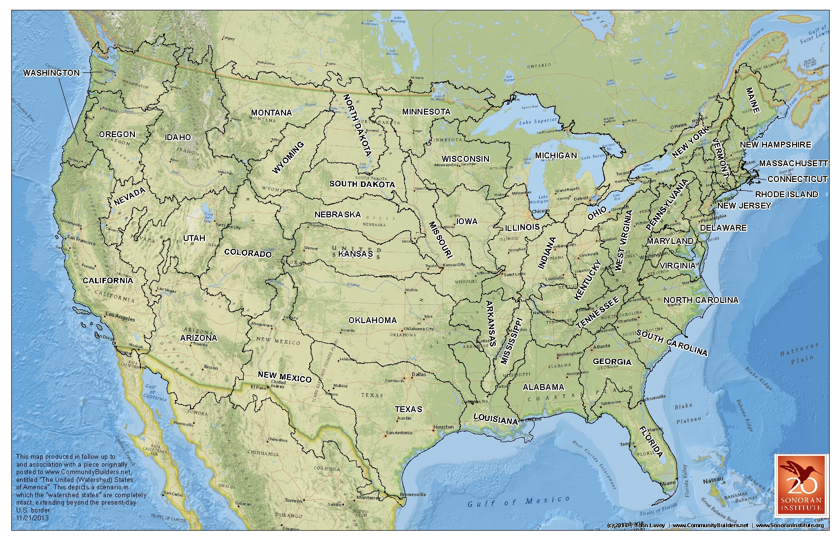
What if one drew the boundaries of states, as John Wesley Powell once suggested, by watersheds and not simply abritrary, straight lines? That’s the basis of a story from Community Builders entitled, The United (Watershed) States of America. John Lavey observes:
Which gets me to my “what if”: What if the Western states were formed around watershed as Powell envisioned? What would that look like and could we speculate on what that might mean for the functioning of modern communities? And since we’re going down that road, let’s ask another what if: What if all of the American states were based around principal watershed, from coast to coast – something even Powell didn’t consider.
Armed with an elementary understanding of GIS and various shapefiles, I set out to create such a map.
Here’s his watershed-boundary map (clicking produces a larger image):
On this day in 1998, a settlement in Wisconsin:
1998 – Wisconsin Enters into Tobacco Settlement
On this date Wisconsin entered into the tobacco “Master Settlement Agreement.” Wisconsin was to receive $5.9 billion over 25 years from leading tobacco product manufacturers. [Source: Tobacco Control Resource Center for Wisconsin]